By Urte Širmulyte
Wildfires are breaking out more often, persisting for extended periods, and burning with greater intensity. From North and South America, across Europe, to Indonesia, Australia, and beyond, the pattern is the same. Wildfire season is getting longer, and in some places, it’s almost a year-round concern. So, what can be done to protect communities, save lives and preserve ecosystems?
In Canada, By June 2023, the country broke records for the largest area burned by wildfires in a single year. That was before the season even reached its peak. In Europe, there have already been close to four times more wildfires than average this year.
According to the United Nations Environment Program, the global situation is escalating fast, with forecasts of a worldwide increase in extreme fires of 14 percent by 2030, rising to 30 percent by 2050.
In many territories, the main causes of fire are lightning, humans, or poorly maintained powerlines. While human-ignited fires cause major problems in populated regions, in boreal forest and woodland around 90 percent of the total area destroyed by wildfires originates from lightning strikes.

Against this worrying backdrop, how can the situation be improved? Can drones provide advantages in firefighting situations? How can they assist with wildfire detection, evaluation, and containment? We spoke to wildfire experts around the world to understand the current circumstances, the shortfalls, and the opportunities to save more lives.
“Fire has an ecological and historical role in many Canadian ecosystems,” John Davies, a senior wildland fire specialist in British Columbia, told us. “Our grasslands and our forests have evolved with fire as a natural means to regenerate. But these large, destructive fires are not natural and they can negatively impact ecosystems. Wildfire patterns are changing, and that’s causing us concern. We need to detect them early, hit them fast, and try to keep them small. By providing real-time, persistent, actionable incident information, we increase the efficiency and safety of our operations.”
EARLY WILDFIRE DETECTION
The speed of wildfire detection and how quickly it can be validated are critical to a successful outcome. Arnoud Buiting, a program director for operational preparation and fire department safety in the Netherlands, provided insights into current detection methods, saying, “Surveillance over the Veluwe, a forested area, is carried out using airplanes, but they are expensive to operate and maintain. Also, recreational users often report wildfires through mobile networks, yet the inability to be present everywhere at once poses a significant challenge. What’s more, the verification of detected fire images and pinpointing precise locations are elements missing from the equation.”
Elsewhere, continuous camera networks are deployed across wide geographical areas, using AI to detect smoke and alert authorities. But they have a limited coverage area. Satellite imagery is another route to detection, yet with a pass-over rate of just once or twice each day, the method can be less effective. Plus, by the time people, fixed cameras, or satellites can identify smoke, the fire has already taken hold.
Drones offer rapid aerial surveillance, and real-time data, enhancing situational awareness and allowing faster response to wildfires, leading to improved detection and coordination among fire management agencies.
One example of innovative technology usage in early drone wildfire detection comes from the Fire Neural Network. Lightning is responsible for the majority of the area burned in the Western US, yet only a small portion (5%) of lightning strikes are capable of starting fires, known as High-Risk-Lightning (HRL) strikes. Fire Neural Network developed a system that quickly and accurately alerts when an HRL strike occurs. Detectors capture high-current lightning strikes, combined with local environmental and fuel characteristics. An AI algorithm combines this data and generates HRL alerts. Once a hazardous strike point is identified, a drone can fly out and verify the ignition location. This real-time information allows first responders to focus their resources on areas of need instead of patrolling large areas without knowing where to look. This technology has been rolled out in the US (Florida), the Australian Capital Territory, and the Brazilian Amazon.

EFFECTIVE COORDINATION AND CONTAINMENT
Detection is only part of the early phase challenge. Once a fire has been identified, crews need to be deployed on the ground at the right location with as much situational awareness as possible. This can take up valuable time.
“When we know there’s lightning, we need to get out there as soon as conditions allow,” says Davies, “but when a lightning storm comes in late evening or overnight, there may not be enough daylight to go look for an emerging fire until the morning due to nighttime flight restrictions. So, fires could be burning for eight or ten hours before they get detected”.
“Things can change quickly. Even in the course of an hour, you can go from receiving a call on a spot fire, to it blowing up into a very large wildfire with the need for helicopters, air tankers, and more ground crews than may have been initially dispatched. And timing is everything. Being able to supplement, or replace the use of aircraft with drones during a busy fire season could provide a key advantage.”
Once a wildfire has been identified, drones can act as scouts, arriving ahead of first responders and allowing remote teams to appraise the situation as it develops. According to Kihan Garcia a mechanical engineer specializing in remotely piloted systems from Wollongong, Australia, drones should collaborate with manned aircraft in wildfire response efforts. They can play a crucial role in providing situational awareness by capturing real-time data and relaying valuable information on optimal locations for planes and helicopters to deploy water drops effectively.
By working in tandem with aircraft, drones enhance the coordination and efficiency of aerial firefighting operations, enabling a more targeted and strategic approach to wildfire containment.
IMPROVING SAFETY FOR WILDFIRE CREWS
When wildfires take hold, crews aim to extinguish them by 10 a.m. the following day, before relative humidity begins to decrease, causing fires to spread. But this isn’t always possible, and by the afternoon the fire can increase, especially when influenced by wind, which plays a critical role in wildfire spreading. It can rapidly spread the flames, carrying embers ahead of the main fire, and creating unpredictable fire behavior. In such a dynamic system, drones provide crucial situational awareness, keeping firefighters safe and well-informed.
“It’s vital that we bring real-time intelligence to first responders,” says Josh Wilkins, a seasoned fire officer and wildfire technology advisor operating in Haily, Idaho. “That’s the overriding objective. Everyone should be fully aware of their own personal situation, and that’s a big ask when you’re facing an unpredictable wildfire situation. We want to be able to save lives by not risking them in the first place, and that’s where drones can play a defining role.”
Drones can also look for spot fires, scanning on the fireline for embers thrown out ahead of the main wildfire. This real-time information prevents crews from becoming trapped, while also evaluating safe zones during rapidly escalating situations. All this data collection also feeds back into the Incident Action Plan (IAP), providing the basis for developing flexible strategies and achieving objectives on a day-by-day and hour-by-hour basis.
ADVANCED MONITORING AND SITUATIONAL AWARENESS
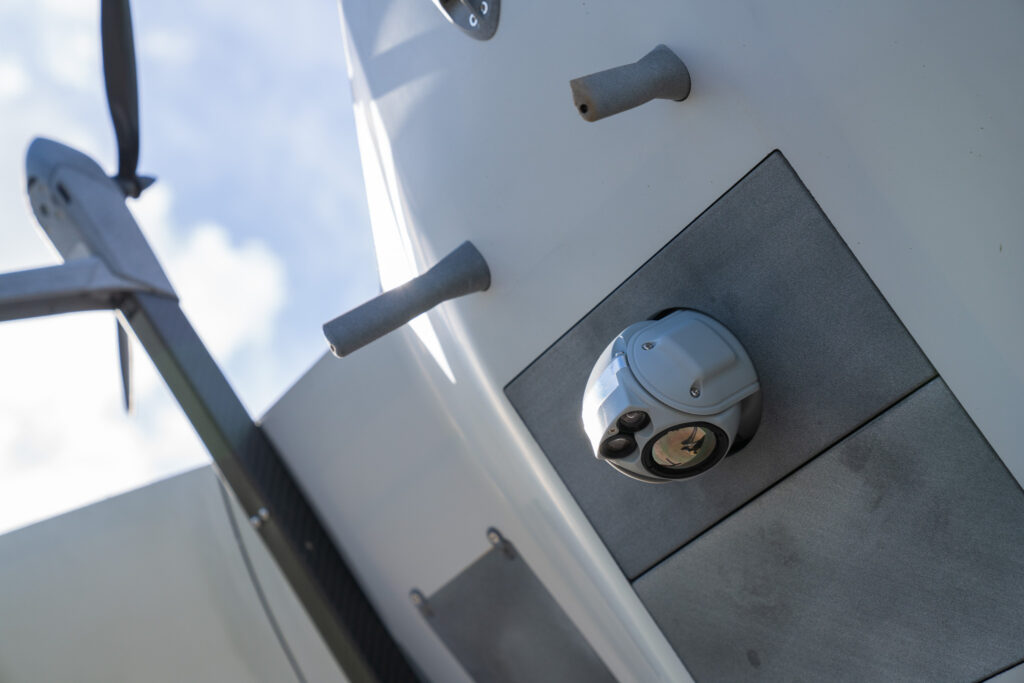
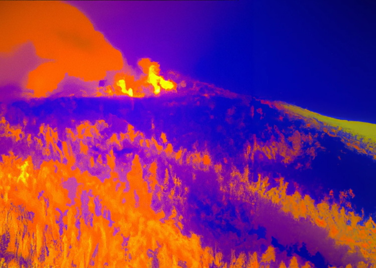
When a hotspot is smoldering on the ground and not yet producing much smoke, sometimes for days, a drone’s thermal imaging camera can be tuned to identify the hotspot before it flares up. As well as being equipped to provide real-time information by scanning perimeters and firelines, drones can also map the vegetation in high definition using multi-spectral imaging, and photogrammetry payloads. This enables accurate predictions for fuel and fire behavior models.
In addition, the information obtained from drone-captured images includes accurate GPS location and timestamps, adding relevance to the visual data. According to Garcia, “Imagery without context is just pretty pictures. By combining high-quality imagery with precise geospatial information, drones deliver meaningful and actionable insights that inform decision-making.”
SUCCESSFUL WILDFIRE CONTROL, AT A LOWER COST
As drones continue to evolve, their ability to save lives expands. They offer cost-effective solutions, with lower purchase and maintenance expenses compared to manned aircraft.
However, some challenges still remain. Beyond Visual Line of Sight (BVLOS) flights do raise local regulatory and logistical issues. Yet, according to Andy Olesen, a consultant in emergency response robot operations from Canada, new regulations are expected to provide advancements. Meanwhile, in the US, regulations are also changing. Wilkins told us, “A new bill in Congress addresses the FAA regulations and the need for rapid adoption of drones in the wildfire environment,” while Garcia adds, “Flying BVLOS in Australia has recently been made more accessible. It now requires an operating certificate, obtained through an exam assessing pilot proficiency in instrument-based flying. With this certification, operators can conduct day and night operations.”
THE DELTAQUAD EVO
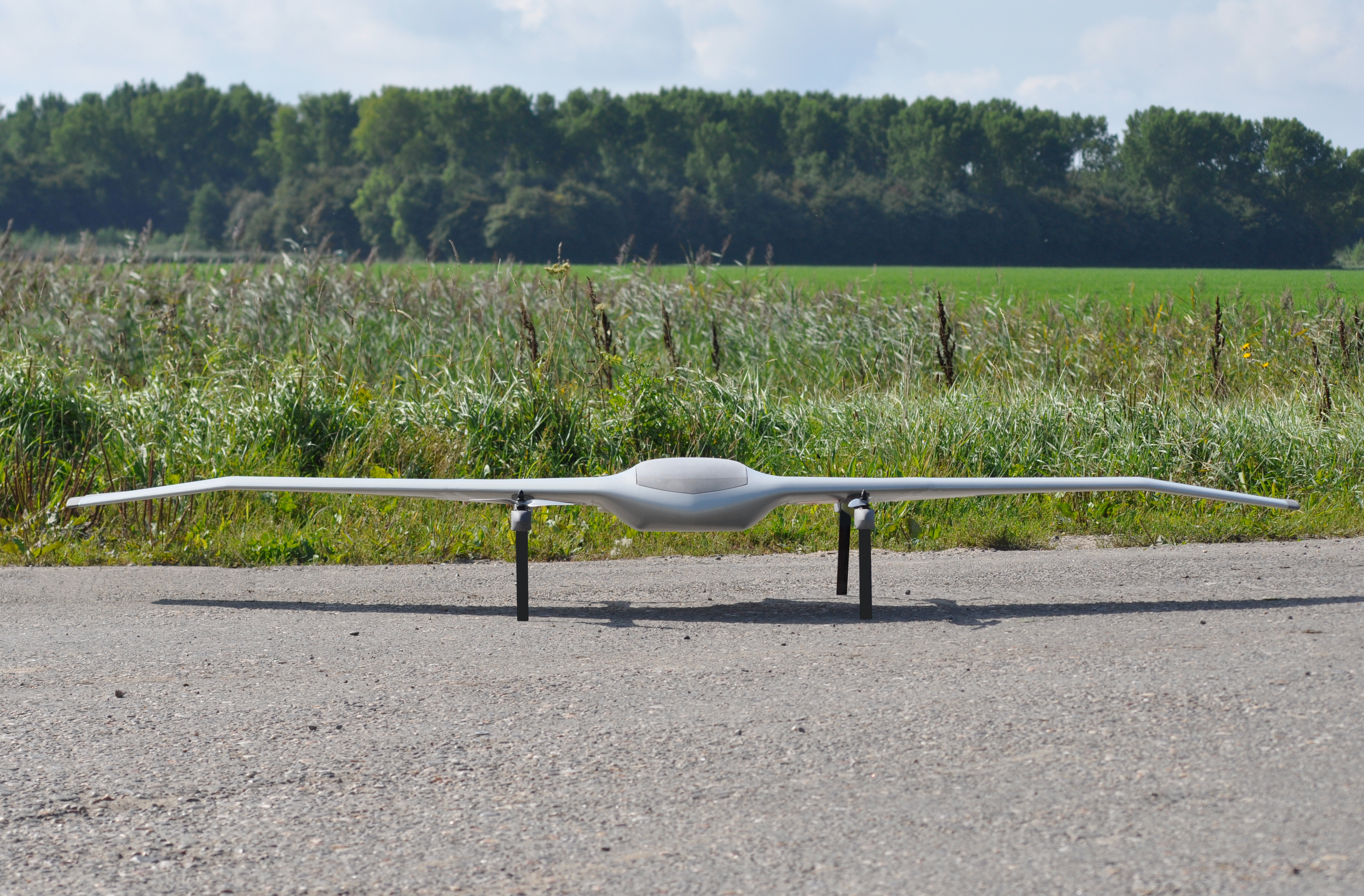
DeltaQuad Evo is a reliable, versatile, and future-proof platform that offers a range of significant advantages for wildfire detection and control. With a flight time of over 4 hours and easy versatile payload capacity, it can cover vast areas and be used to perform different kinds of missions, like capturing high-resolution imagery, thermal data, and other essential information critical for effective wildfire detection and analysis. Since it’s simple and quick to swap payloads, you can use a single drone for additional missions, like vegetation mapping, or perform a specific search and rescue mission.
It can operate over extended distances, making it ideal for monitoring remote or hard-to-reach wildfire-prone regions or performing perimeter scans. Built for stability and durability, Evo can withstand harsh environmental conditions often encountered during wildfire situations. Moreover, its autonomous operation feature allows for pre-programmed flight paths and systematic grid searches, optimizing efficiency in surveying large territories.
By harnessing these capabilities, DeltaQuad Evo serves as a powerful tool for efficient and precise wildfire detection and monitoring, significantly enhancing wildfire management and response efforts. Interested in learning more about DeltaQuad Evo? Contact us to discover what we can do for you.


