
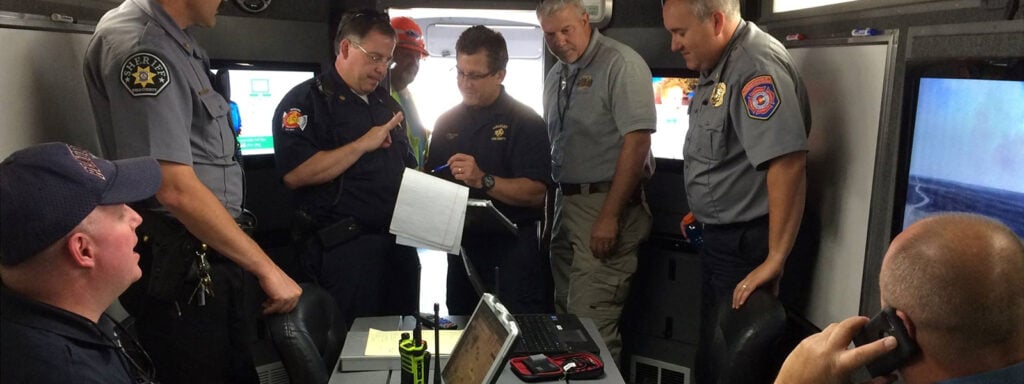
One complex challenge in fighting fire from the ground and the air is integrating the rapid growth in available technology into firefighting operations. The Center of Excellence for Advanced Technology Aerial Firefighting (CoE), the research and development section of Colorado’s Division of Fire Prevention and Control (DFPC), is attempting to do just that with its latest offering, “COTAK.”
AerialFire recently spent time with Brad Schmidt, DFPC’s Deputy Director of Spatial Projects and the program lead on the COTAK Program, to learn more about what the state is doing to aid in wildfire technology.
What is COTAK?
The U.S. Military initially developed the Tactical Assault Kit (TAK) program for tactical operations, which was recently released to state agencies after it was surmised that the technology used on the battlefield could also be used on a state and federal basis for assisting in wildland firefighting and other public safety operations. The civilian version of TAK, known as the Team Awareness Kit, was adopted by Colorado as one of the first states to try and integrate the technology into the wildfire world; the Colorado version of the program was branded as COTAK as a method initially to track wildfire growth, bringing in more than the currently available GIS mapping, and making the product mobile, able to be used by ground units via mobile phones also to track their position in the field.
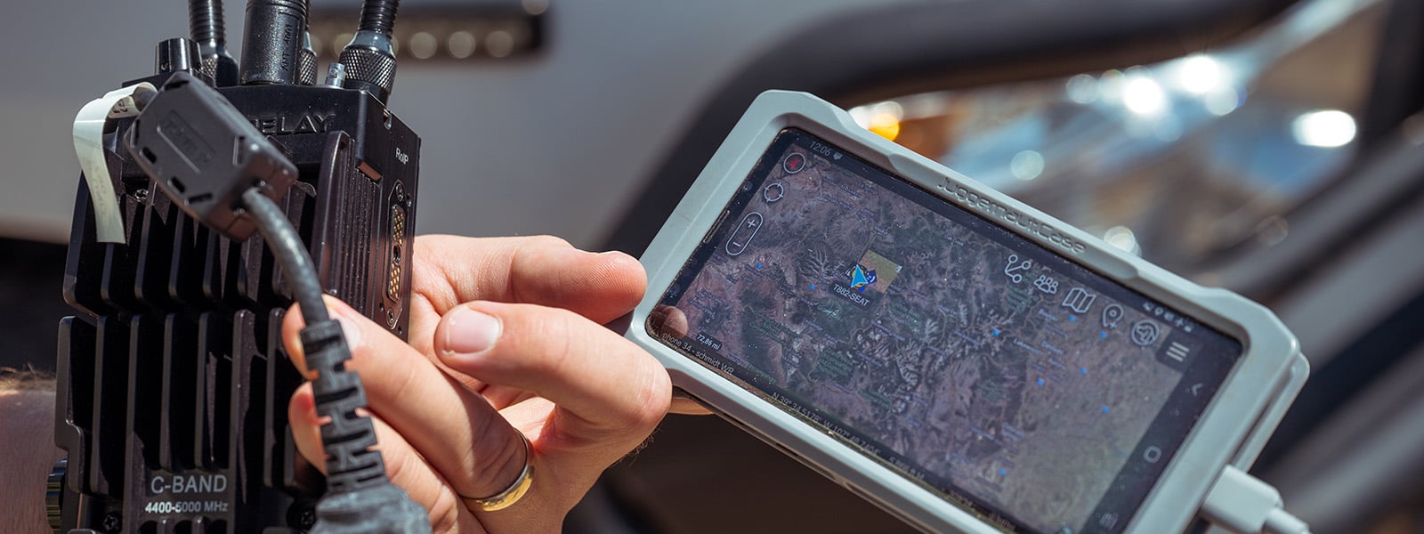
What the product, thanks to several years of development, has become is an industry-leading piece of technology that allows crews on the ground to not only view the real-time location of first responders but also fire apparatus, fire mapping data, and drone traffic in the area and thanks to the addition of ADSB input, the location of incoming air attack and firebombing aircraft to the firefight in real-time, changing the game of how we view and fight fires on the ground and in the air. COTAK allows users to see what was previously held between computer programs, mobile apps with limited data, paper maps, and radio communication.
“TAK " came from military research and development efforts, which happened to be similar to what we were looking for. We looked at creating a real-time wildfire map beyond just having the GIS data on where the fire is burning. We wanted to add real-time information on the location of aircraft, the location of vehicles, and the locations of firefighters and create that real-time map. And so that's where we identified TAK as a technology that does that, and it was free of charge for us to adopt on the civilian side,” said Schmidt.
Unlike many other agencies, Colorado’s DFPC comes under the control of the state Department of Public Safety, so in addition to firefighting operations, COTAK is also used to support law enforcement operations, specifically being of great assistance during search and rescue operations to show the location of search parties and areas already covered when searching for missing persons.
Federal Adaptation
With the initial success of COTAK and the need for further development, the TAK program has also extended to the federal firefighting side with the introduction of WFTAK (pronounced WOOFTAK), branded as the Wildland Fire Team Awareness Kit, being deployed to the USDA Forest Service. DPFC’s technology and knowledge are also being tapped to assist in developing the same product on a federal level to assist on a national level.
Future Development
Part of the complexity of designing, updating, and managing a system like this is deciding what to monitor and ensuring that all resources responding to a fire are online within the system. One of the major advancements the team at DFPC’s Center of Excellence is aiming to address is weaving all of the contracted aircraft into the system so that all people using either COTAK or WFTAK in the future have a complete picture of both ground and aerial assets available to fight the fire.
“It is a very complex system with a lot of players in it, so currently, we're testing WFTAK with the Federal Forest Service in the Pacific Northwest, but we are looking to expand that testing to start figuring out how we'll bring cooperative and contractor resources into it as well. In some cases, it may create accounts in the system for them to use, similar to how they can access other federal software. And then, in other cases, it may be integrating with third-party tracking systems to bring information in automatically.” said Schmidt.

How Does it Work?
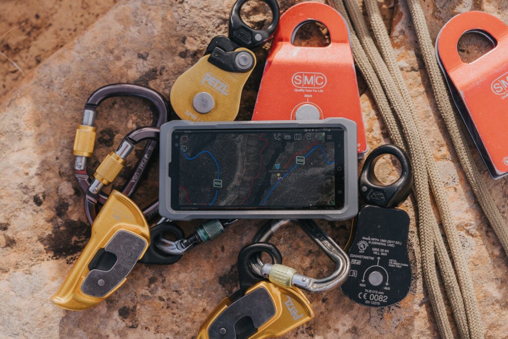
The COTAK system is primarily a cloud-based technology, with its technology stored in a cloud-based server, which protects it from technology outages suffered by hardwired systems, such as the system chaos caused by the recent Cloudstrike outages, which caused massive issues throughout many industries.
From a user perspective, the COTAK and WFTAK systems can be run on iOS—and Android-based mobile devices in the field and on a Windows-based application via laptop computers. A Linux/Mac app is currently being developed to make the COTAK system available on almost any platform for use in the field.
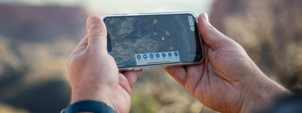
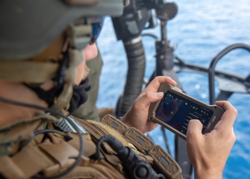
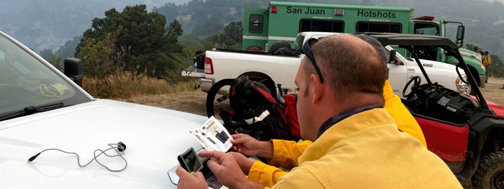
Once deployed on a device, COTAK users with approved credentials issued by the DFPC CoE can then access a server to obtain the real-time fire information needed on the fireground that will display fire mapping, personnel and fire apparatus information and the location of incoming aerial assets to a specific fire location.
Technology Limitations
The COTAK system relies on cellular technology to provide location data through repeater stations and cell towers, which in remote areas can be a challenge as service can sometimes be less than optimal. The CoE team is currently working on further solutions to improve connectivity to the system that include the installation of remote cell technology repeaters and, in the long term, the hopeful addition of satellite compatibility that may consist of the use of the StarLink system in the future to make the system truly able to work in any remote location with no service or transmission delays based on lack of connectivity.

Using COTAK
The COTAK system brings to the fireground a staggering amount of previously unavailable information in a single application, which for certain aspects of the firefight may seem to be “drinking from a firehose” regarding the amount of information available. In an aerial firefighting application, at least from the CoE application perspective, COTAK is also even capable of providing near real-time fire perimeters from one of DFPC’s next-gen aircraft fleet of PC-12 aircraft equipped with full-motion video cameras that can provide fire detection, mapping, and video feeds if needed for a specific aspect of fighting the fire, especially useful to initial attack and retardant dropping aircraft.
While the amount of data available could seem daunting, Schmidt stated that information is easily accessible and easy to drill down. Like common aviation programs like Foreflight, COTAK also allows for scaling information availability up or down based on the user's needs by providing layers of information that can be switched on or off based on the end user’s requirements and needs.
Sharing Technology
TAK software is an open-source program initially provided by the military; however, other state and even international agencies have already made use of the TAK technology in addition to DFPC, and while the Center of Excellence has spent considerable time and resources developing the technology now branded as COTAK, they are also open to assisting other agencies who are either looking to create their version or offering assistance in how to go about building their own or sharing some of the development that their team has made, as they are doing on the federal level with WFTAK.
Users outside the United States include the South Australian Fire Service, which also utilizes the technology to provide real-time monitoring of Australia's ever-growing fire risk.
Future Needs
Providing the core technology to run and monitor COTAK is one of the challenges the DFPC CoE faces in the long term, but it is being looked at in several different forms. While the ability to run the core location software through app-based technology on a cell phone seems easy, monitoring needs other options when that task is moved to the non-human element, such as fire apparatus on the ground or aircraft. Aircraft are easier to solve as almost every aircraft can provide ADSB-Out technology as standard. Older aircraft can now be fitted with inexpensive (in relative aviation terms) technology, such as a stratus device providing the needed ADSB-Out signal. Progress is still being made for a reliable and cost-effective fixed-based communication device that will enable ground assets to be monitored effectively on a larger scale at a low price point. Still, the C oE is confident this will soon be a relatively easily solved problem.

Ongoing Development
The Center of Excellence has no plans to stop the continued improvement of COTAK and continues to evaluate the needs and wants of those who fight wildfire. One of the most recent developments underway involves the reporting via ADSB of prescribed burn helicopters, which will also include their tracking data that will show areas that have already had a prescribed burn conducted, helping those planning the firefight from the ground and the air, valuable information on areas that have already had ground fuel eradicated as yet another essential piece of information in the jigsaw that is fighting wildfire.
Conclusion
Colorado’s DFPC and the Center of Excellence have been at the forefront of developing technology for the aerial firefighting industry since its inception. The ongoing development of COTAK and their ongoing involvement in the development of the national WFTAK product that will benefit aerial and ground firefighters for years to come continue to demonstrate the value of the forward-thinking of the state of Colorado for the benefit of the rest of the country and the citizens of Colorado. COTAK will likely save the lives of firefighters and citizens through advanced technology in the coming years.