No Result
View All Result
AerialFire
  • Articles
    • Columns
    • Cover Stories
    • Drone/UAS
    • Feature Stories
    • Fire Regulations
    • Government
    • Ground Ops
    • Helicopter
    • International Operations
    • LAT
    • Press Release
    • Retardant
    • SEATs
    • Technology
    • VLAT
    • Wildfire
  • Store
  • Current Issue
  • Contact Us
Subscribe
AerialFire
No Result
View All Result
Home Aerial Fire News

FireTrac Captures Astonishing Scar Burn Aerial Image from Elgin Bridge Fire in Arizona

by Ryan Mason
June 29, 2022
in Aerial Fire News, Fire Regulations, Press Release, Wildfire
Reading Time: 2 mins read
FireTrac Captures Astonishing Scar Burn Aerial Image from Elgin Bridge Fire in Arizona

FireTrac is the definitive wildfire tracking app built by the aerial firefighters at Bridger Aerospace, whose mission is to save lives, property, and habitats threatened by wildfires. 

Late in the morning of May 23, 2022, Arizona Forestry crews began to work the Elgin Bridge Fire a quarter-mile northeast of Elgin, Arizona. Elgin, about 45 miles from Tucson, a small town that is home to 300 people.

Though small, Elgin is Hollywood famous. The train sequence in “Oklahoma!” was filmed in Elgin. As were scenes in  “3:10 to Yuma,” “Red River” (starring John Wayne and Montgomery Clift), and “The Sons of Katie Elder.”

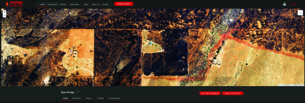
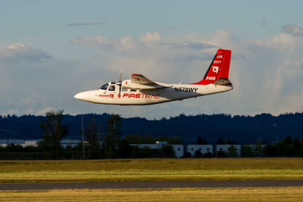
Not long after the Elgin Bridge fire was extinguished, FireTrac pilot Rich Mutari and sensor operator Ryan Powell flew over the fire to capture high-resolution scar imagery.

“The Elgin Bridge Fire was one of three fires we mapped that morning,” said Powell. “We notified the Region 3 Aircraft Ops Manager that we would be overhead. We arrived after the fire burned out to capture high-resolution electro-optical imagery of the fire scar. We also checked for hotspots with our IR sensors but found none.”

“We were overhead for less than 10 minutes and then off to the Black and Bear Trap Fires,” Powell said. “Capturing fire scars offers historical fire data for post-fire analysis. It’s also beneficial for evacuees to see their property before they are able to return so that they can make necessary arrangements based on their needs,” according to Powell.

FireTrac planes are equipped with the wildfire mapping TK-7 sensor from Overwatch Imaging. The TK-7 is a multi-spectrum precision survey payload designed to provide advanced precision mapping and multi-image orthophoto capabilities. The sensors can quickly synthesize high-fidelity aerial imagery and detect anomalies, including hot spots.

The sensor uses a nadir-oriented multi-megapixel color focal plane array (FPA) and co-bore-sighted infrared (IR) sensors integrated with an onboard image processing system.

Once the Elgin Bridge fire climbed Mustang Mountain, the Santa Cruz County Sheriff issued evacuation orders for all residences along Mustang Ranch Road.  The FireTrac imagery clearly shows how close the fire came to homes and businesses.

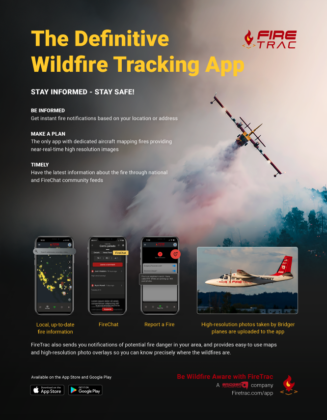
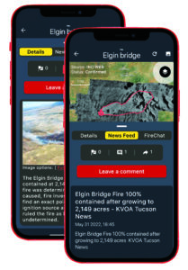
In addition to high-resolution imagery, the FireTrac app provides local, up-to-date fire information, neighbor chat, and the ability for people to report fires and upload their own imagery.

The FireTrac app was created by Bridger Aerospace, an industry leader in aerial wildfire management, relief, and suppression. Bridger offers comprehensive and task-specific solutions to provide maximum support to firefighters on the ground.

FireTrac imagery is captured in partnership with Overwatch Imaging. Bridger Aerospace has partnered with Overwatch Imaging to launch an aerial fire-mapping platform capable of providing high-resolution fire imagery to app users. With Bridger’s aircraft and the Overwatch TK-7 Earthwatch camera system, users can access accurate fire maps to stay informed of critical intel.

Visit www.firetrac.com or download the app in the Apple or Google Play app stores.


Tags: Aerial FirefightingApp StoreAppleBridger AerospaceElginElgin ArizonaFire TracGoogle PlayOverwatch Imaging

Ryan Mason

Related Posts

TBM 960 Aircraft Deploys for First Wildfire Season

TBM 960 Aircraft Deploys for First Wildfire Season

by AerialFire Staff
May 28, 2025

ABBOTSFORD, CANADA (May 27, 2025) – Conair Group Inc. (Conair) has deployed two Daher TBM 960 Air Attack aircraft for...

Entrol Strengthens Pilot Training with the Delivery of S-64 FTD Level 6 Simulator to Korea Forest Aviation Headquarters

Entrol Strengthens Pilot Training with the Delivery of S-64 FTD Level 6 Simulator to Korea Forest Aviation Headquarters

by AerialFire Staff
May 27, 2025

● Simulator based on the complex S-64E helicopter, designed for specialized firefighting training. ● Equipped with complete ENWALL LED technology,...

Tabula and Plane Finder Partner to Deliver ADS-B In Capability for Enhanced Cockpit Awareness

Tabula and Plane Finder Partner to Deliver ADS-B In Capability for Enhanced Cockpit Awareness

by AerialFire Staff
May 23, 2025

Mosgiel, NZ, May 23, 2025 - Tabula, a leading provider of job management and fleet tracking solutions for aerial operations, has...

Avincis Secures Firefighting Contracts in Spain for 14 Aircraft

Avincis Secures Firefighting Contracts in Spain for 14 Aircraft

by AerialFire Staff
May 22, 2025

ALICANTE, Spain – May 22, 2025: Avincis, Europe’s leading provider of emergency aerial services, has been awarded new wildfire response...

Trending News

No Content Available
TBM 960 Aircraft Deploys for First Wildfire Season
Press Release

TBM 960 Aircraft Deploys for First Wildfire Season

by AerialFire Staff
May 28, 2025
Entrol Strengthens Pilot Training with the Delivery of S-64 FTD Level 6 Simulator to Korea Forest Aviation Headquarters
Aerial Fire News

Entrol Strengthens Pilot Training with the Delivery of S-64 FTD Level 6 Simulator to Korea Forest Aviation Headquarters

by AerialFire Staff
May 27, 2025
Tabula and Plane Finder Partner to Deliver ADS-B In Capability for Enhanced Cockpit Awareness
Aerial Fire News

Tabula and Plane Finder Partner to Deliver ADS-B In Capability for Enhanced Cockpit Awareness

by AerialFire Staff
May 23, 2025
Avincis Secures Firefighting Contracts in Spain for 14 Aircraft
International Operations

Avincis Secures Firefighting Contracts in Spain for 14 Aircraft

by AerialFire Staff
May 22, 2025
AerialFire

© 2025 AerialFire, a Marsayl Media Publication. All rights Reserved.

Navigate Site

  • Privacy Policy
  • Terms of Service
  • Advertise With Us
  • Contact Us

Follow Us

No Result
View All Result
  • Home
  • Subscribe
  • Store
  • Current Issue
  • Advertise With Us
  • Contact Us

© 2025 AerialFire, a Marsayl Media Publication. All rights Reserved.

Skip to content
Open toolbar Accessibility Tools

Accessibility Tools

  • Increase TextIncrease Text
  • Decrease TextDecrease Text
  • GrayscaleGrayscale
  • High ContrastHigh Contrast
  • Negative ContrastNegative Contrast
  • Light BackgroundLight Background
  • Links UnderlineLinks Underline
  • Readable FontReadable Font
  • Reset Reset